A Leading Weather
Software Solution Provider
Software Solution Provider

Every meteorological office prepares products that interpret the weather for end-users and customer organisations: TV & radio stations, newspapers, media, ship operators, farmers, air-traffic control, pilots, energy companies, and the office's own websites and applications. Meteorologists need tools to produce graphical charts, tables, weather alerts, text documents, websites, or raw data. Task and role management is necessary on top to organise the workload of the individual job positions throughout the forecasting shift.
Visual Weather has grown from its visualisation roots to become a powerhouse in the textual and graphical production of forecasts and warnings. It is widely used by public weather services, airports, and private meteorological companies that rely on Visual Weather to manage the workflow around their production needs.
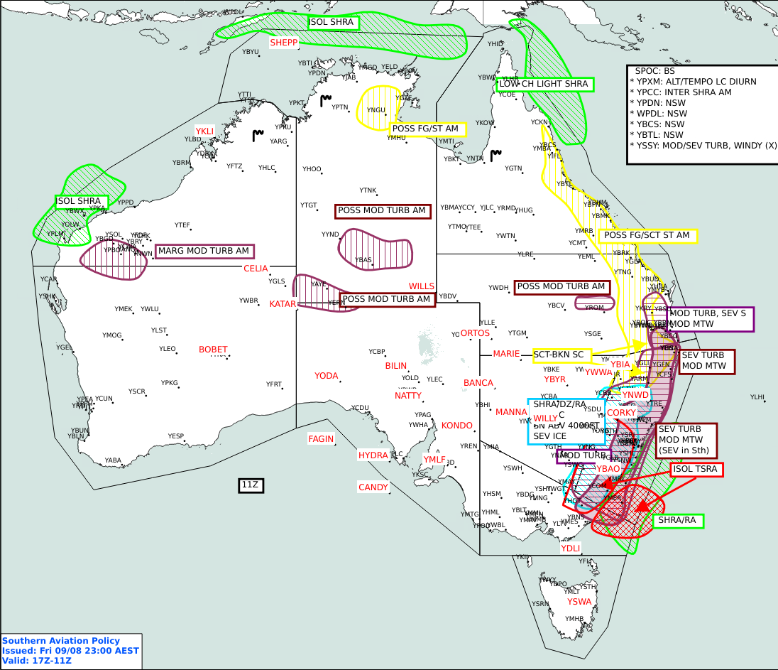
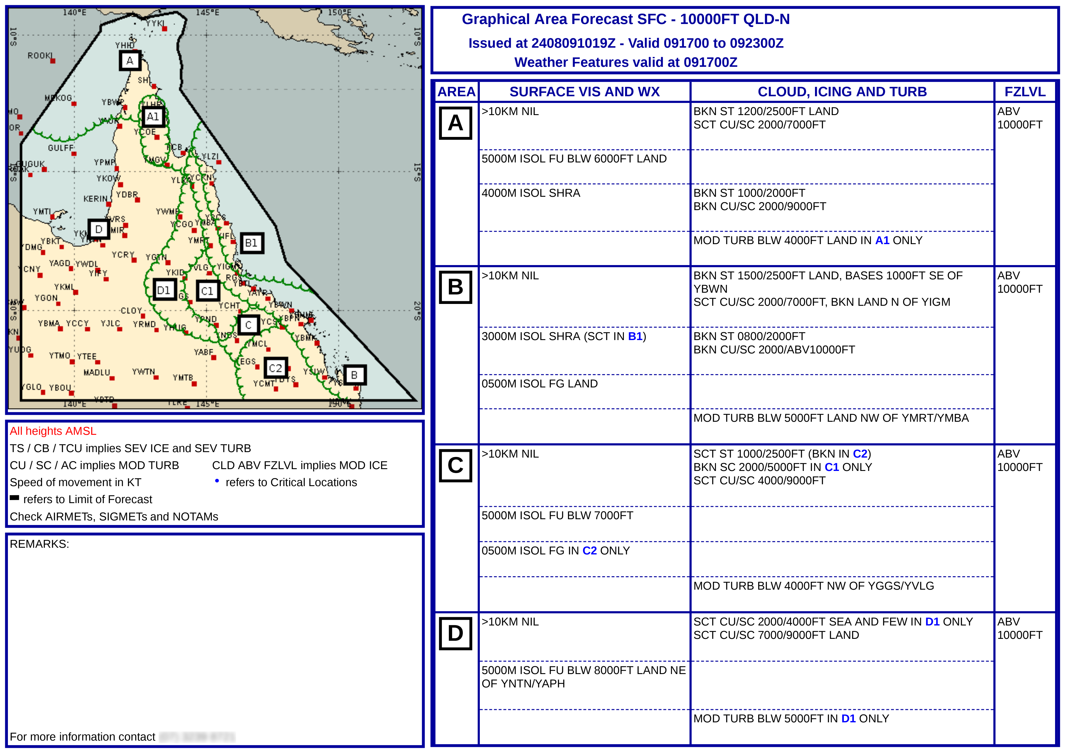
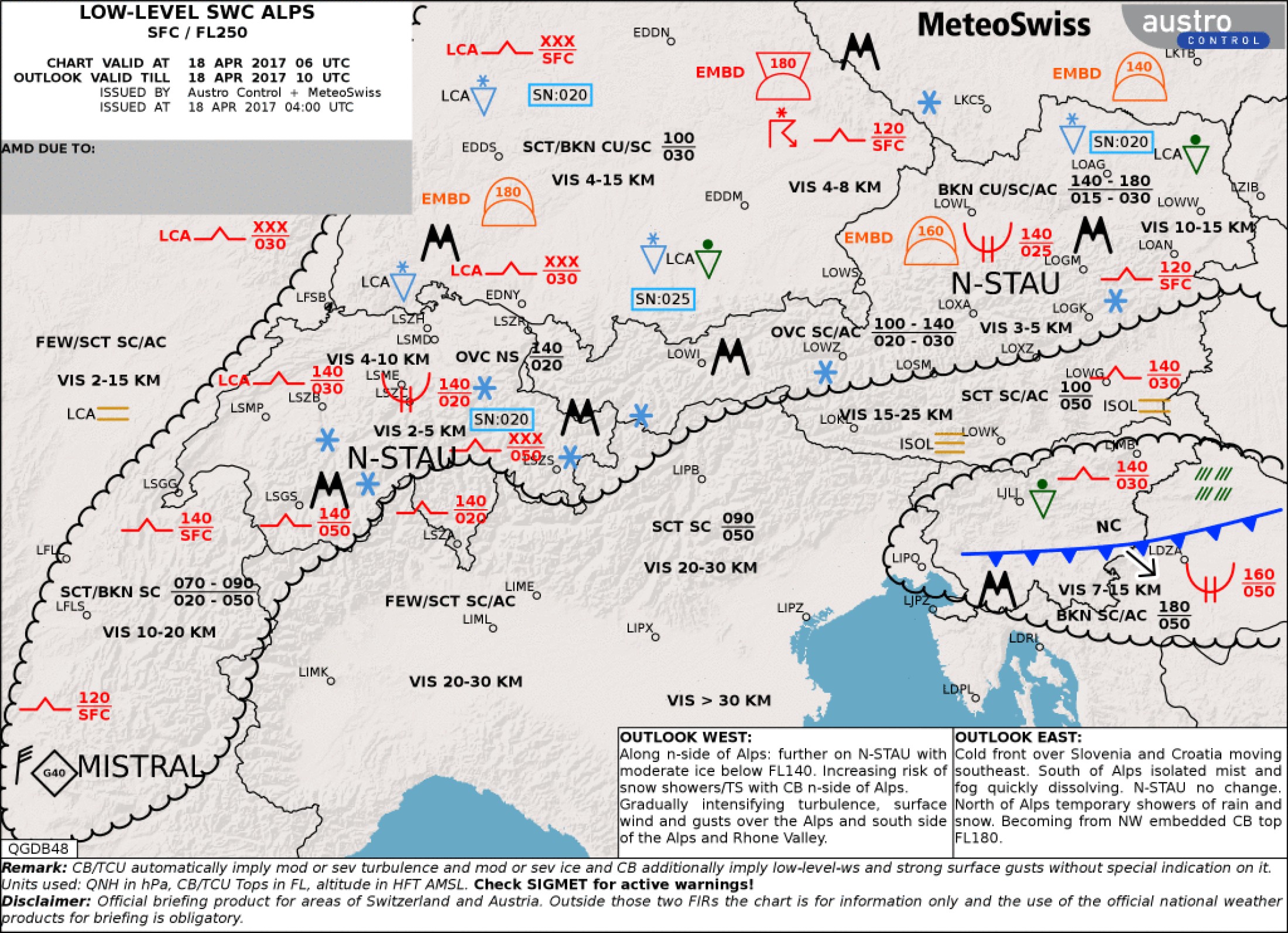
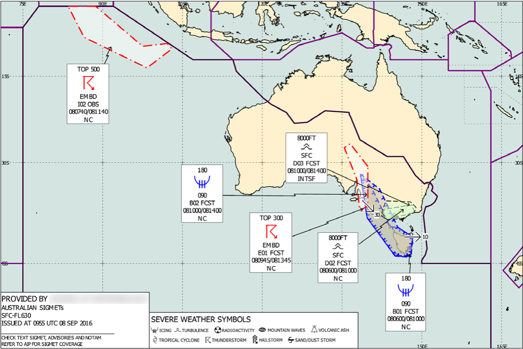
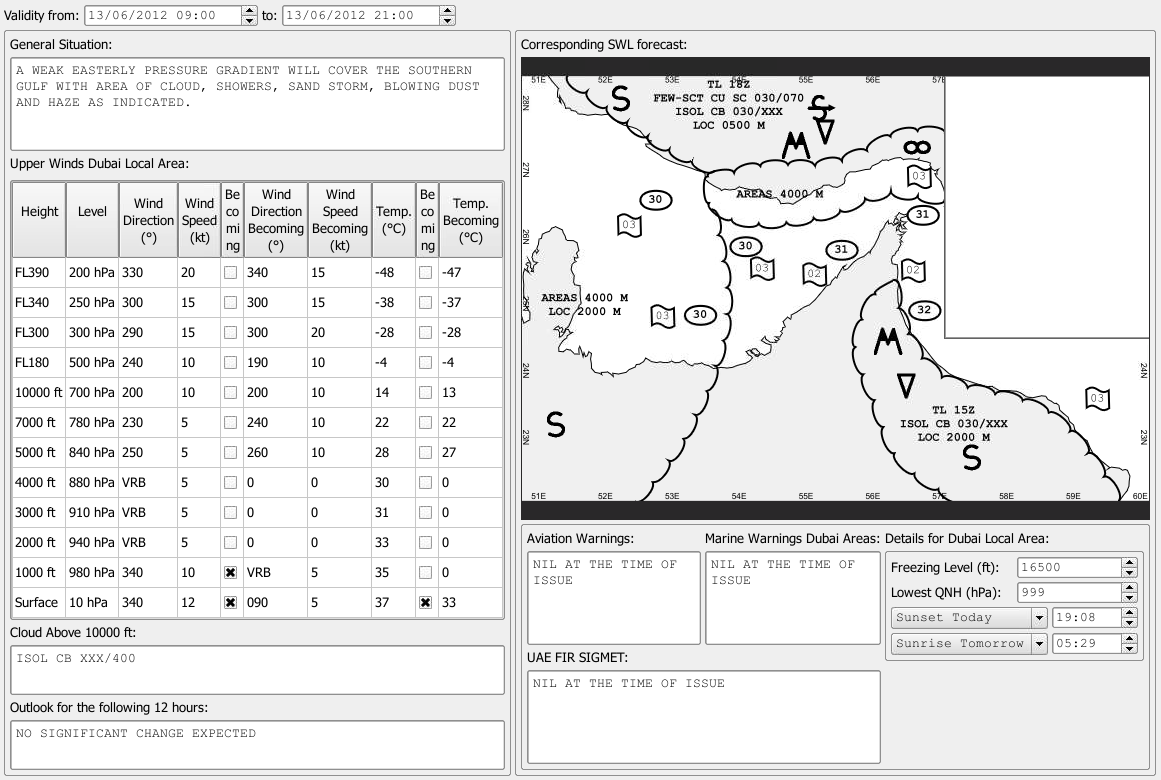
Visual Weather provides a drawing suite where users place meteorological features onto the map, such as fronts, cloud areas, turbulence areas, isobars, and wind streamlines.
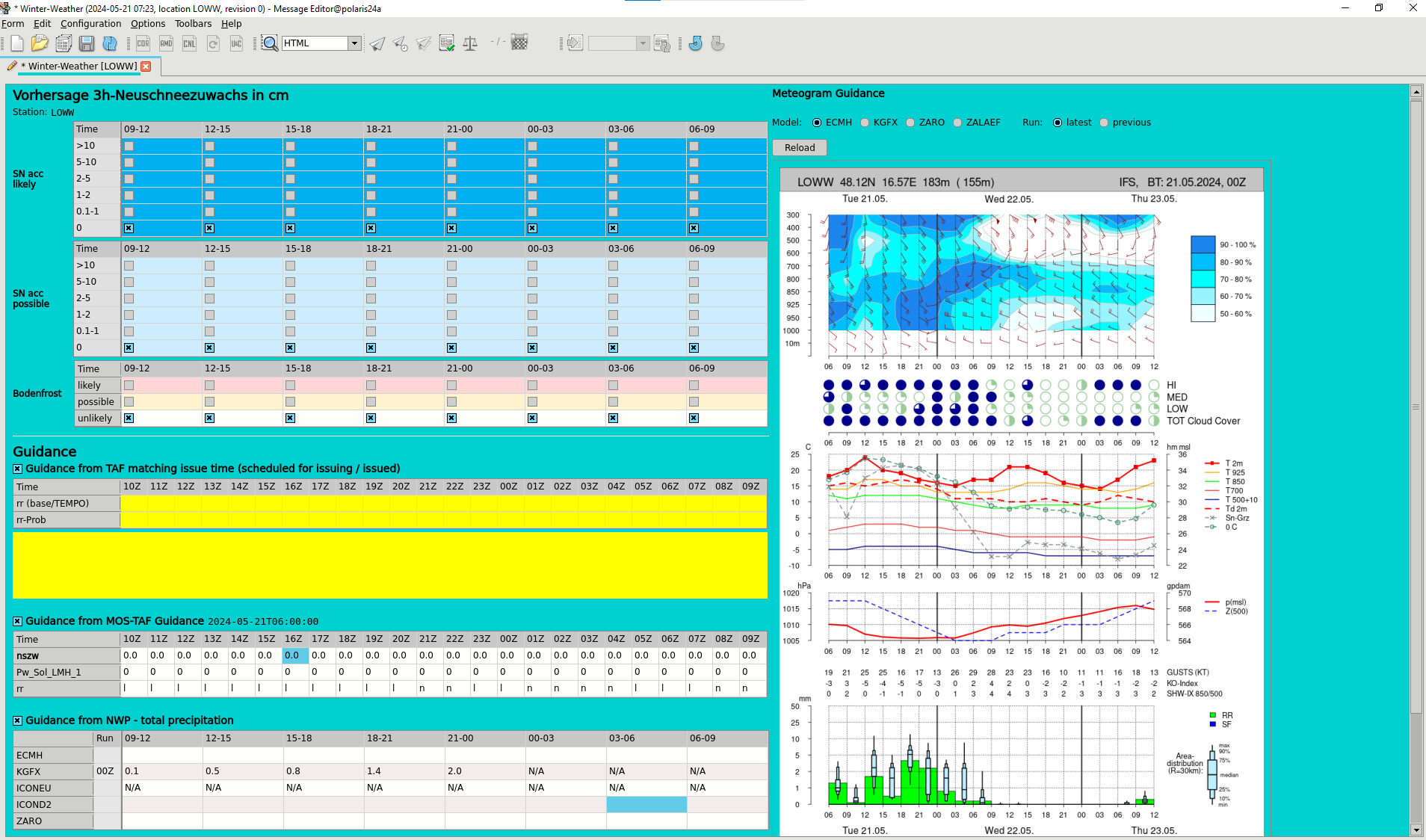
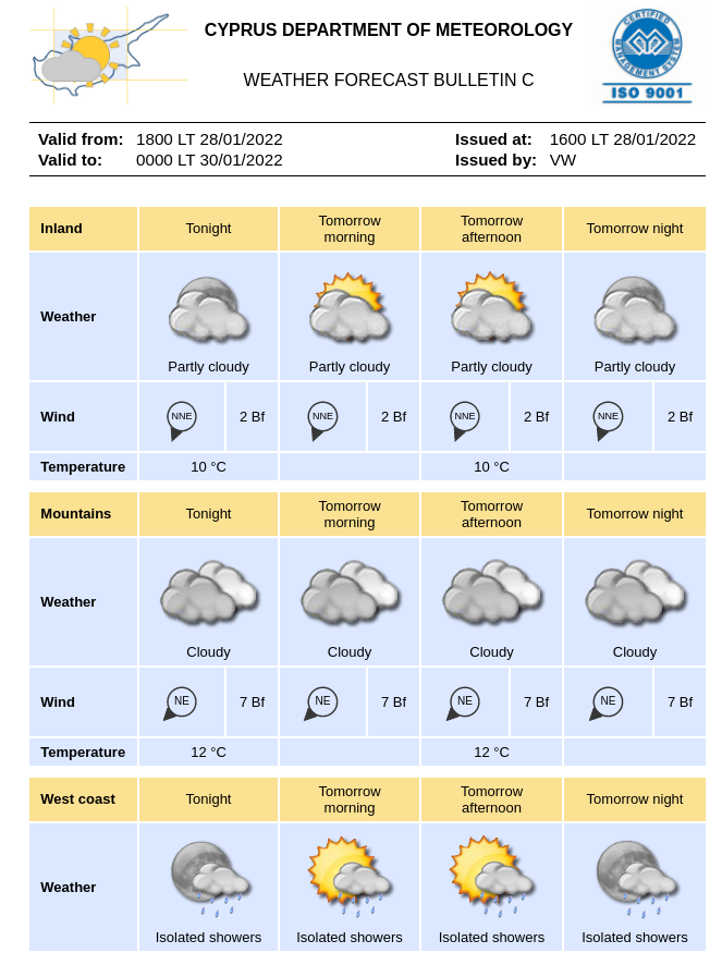
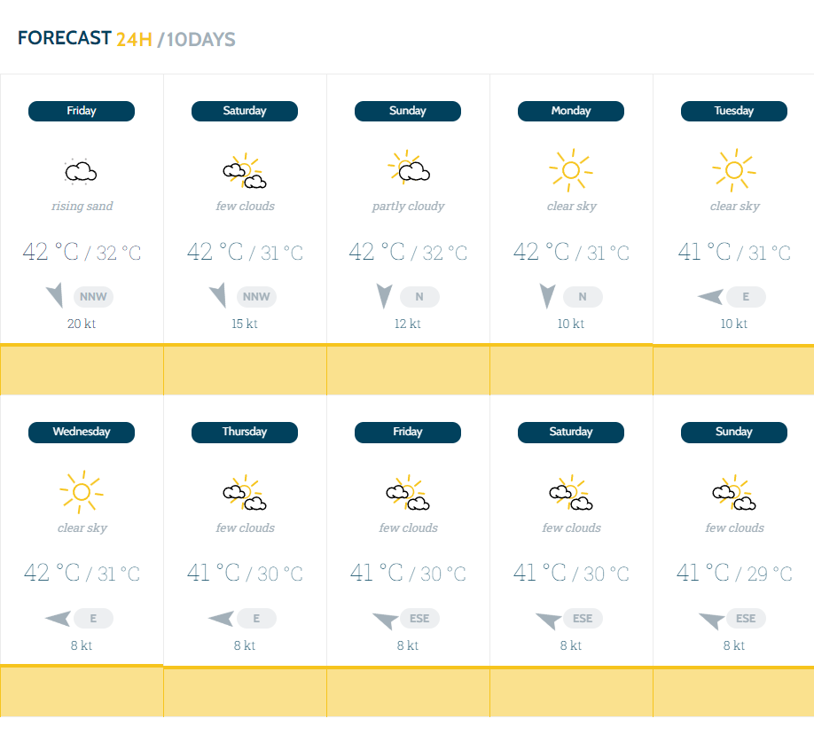
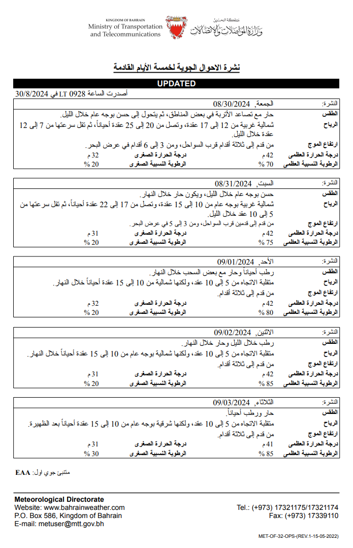
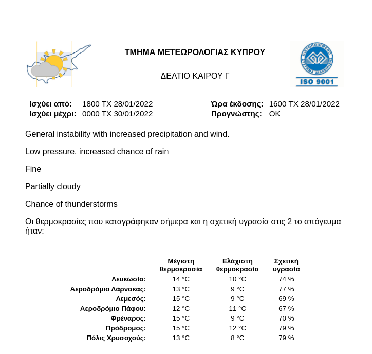
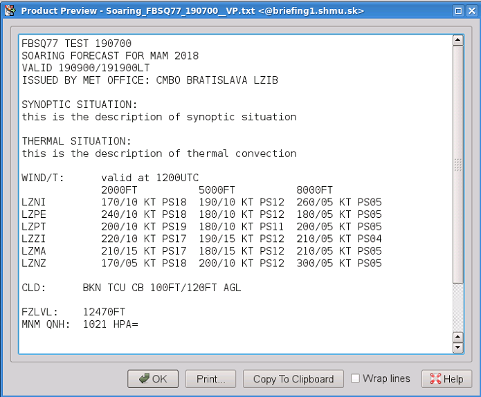
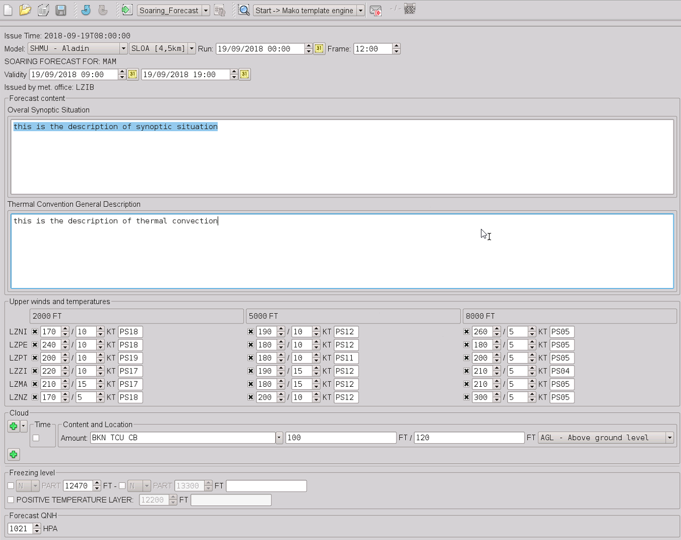
Visual Weather offers robust text production for meteorologists to create forecasts and alerts via customizable entry forms. Users can design their own forms for the Message Editor application or seek help from IBL. A single form can result in multiple outputs (text, HTML, PDF, LibreOffice, JSON, XML), with graphical quality limited only by the design effort. Results can be published on websites, social media, sent to media outlets, customers, or integrated into mobile/web applications.
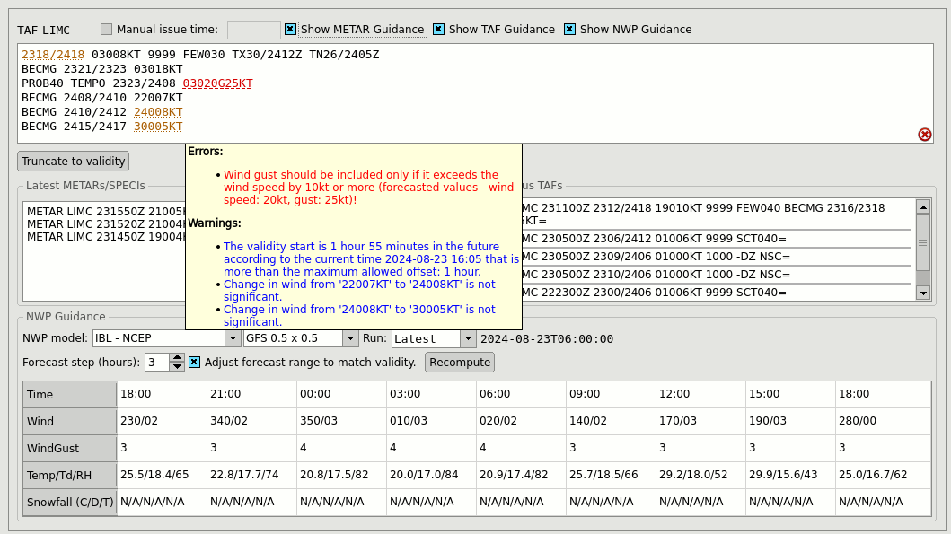
Go to Aviation forecasting made easy to see how Message Editor helps users create TAF, METAR, or Aerodrome Warnings.
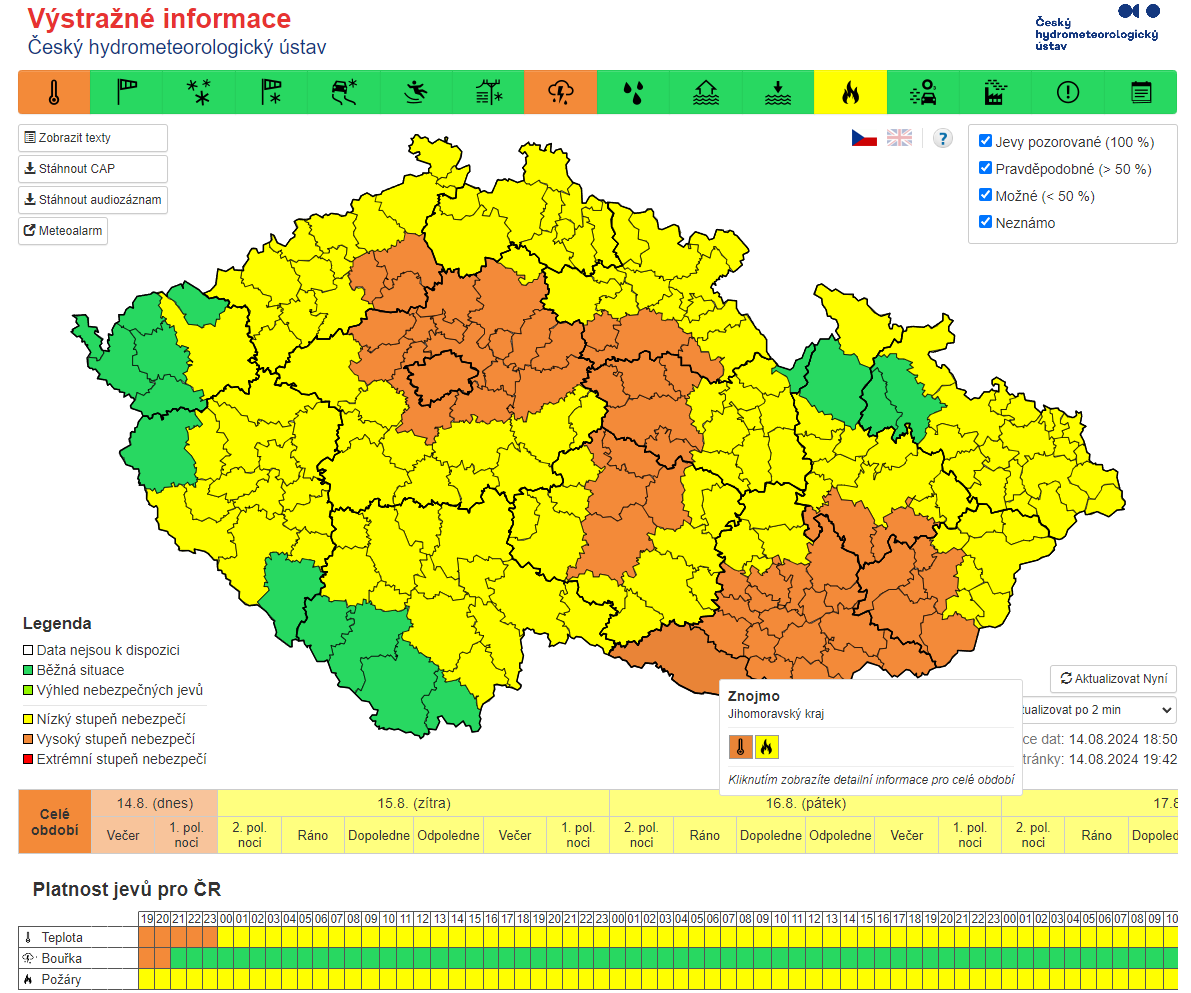
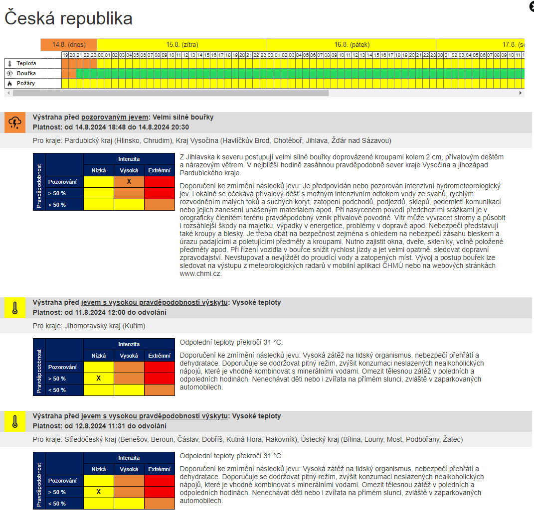
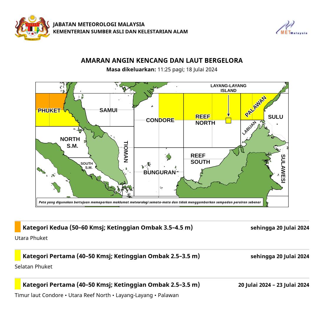
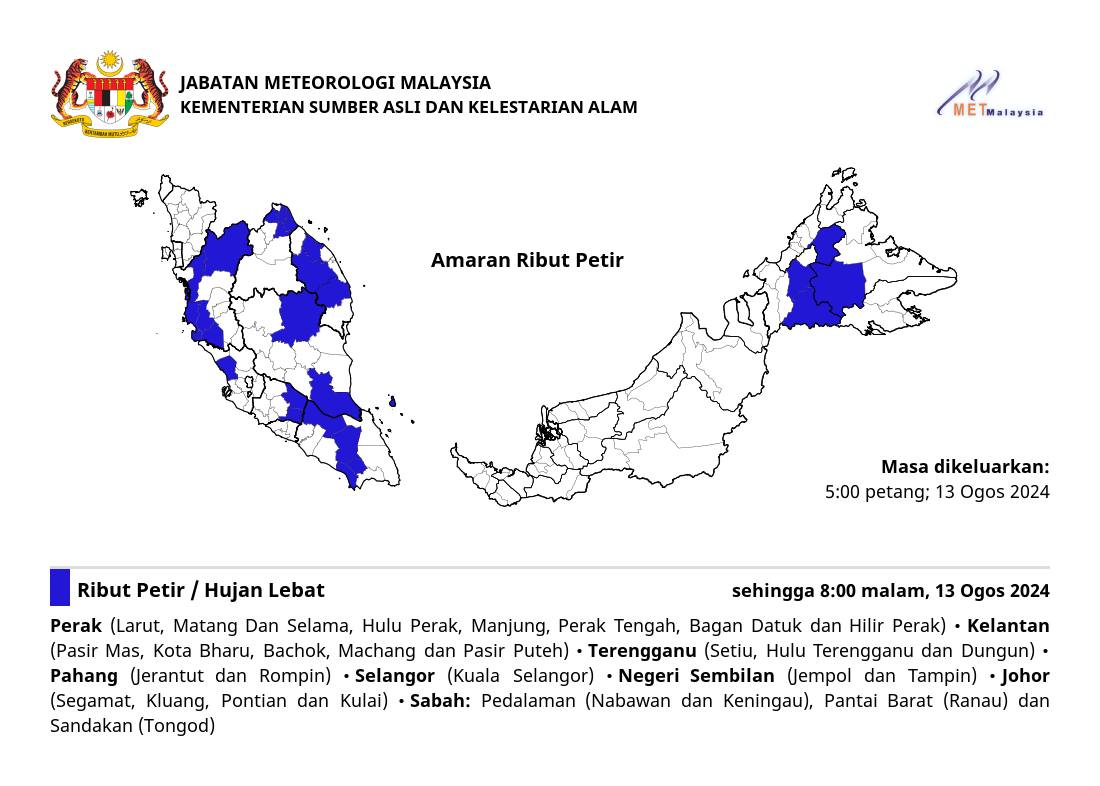
Create weather alerts for your country, marine and custom areas. The Alert Editor application can be customised with a map provided by you, custom hazard types, and a range of outputs that can range from simple text all the way to posts to social media like Facebook & Twitter and interactive web applications.
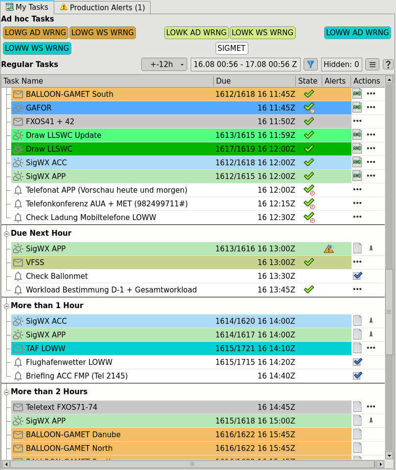
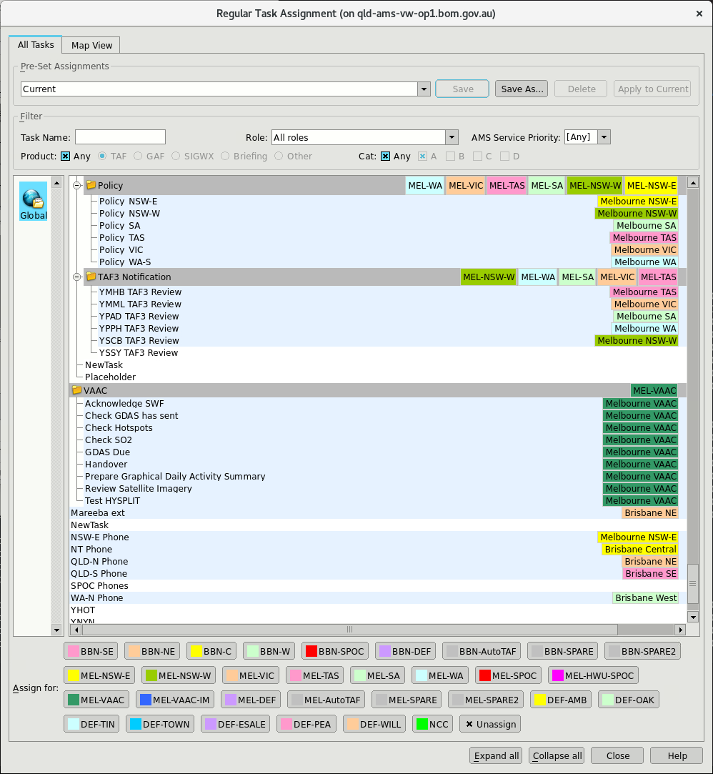
Assign tasks based on forecasting roles, with defined issue windows and due times. The task list monitors progress and encourages timely completion and alerts users if deadlines are at risk. Create task assignment presets for both business-as-usual and critical situations to divide the work between forecasting positions based on the workload.
Task list features:
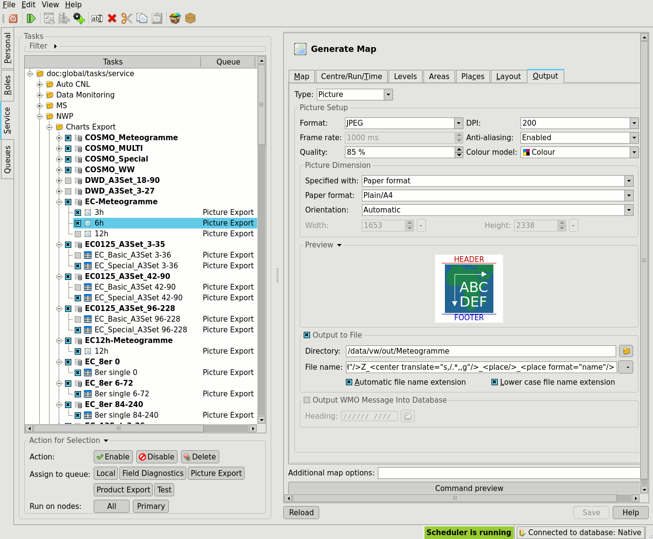
Automate tasks that do not require human intervention. Tasks can be triggered by the reception of NWP model parameters, incoming data, availability of observations, weather thresholds applied to observations or models, or simply on a fixed schedule. Most users run batch production 24/7, which includes: