Satellite Weather

Satellite Weather

Satellite Weather is an autonomous and reliable software solution designed for receiving, processing and visualising satellite data focusing on imagery from geostationary meteorological satellites.

With powerful visualisation, Satellite Weather helps you to monitor and analyse weather patterns with satellite technology and generate accurate insights and predictions for various meteorological applications. The abilities can be further extended by integration with other IBL or third-party software.

Ready for Meteosat Third Generation

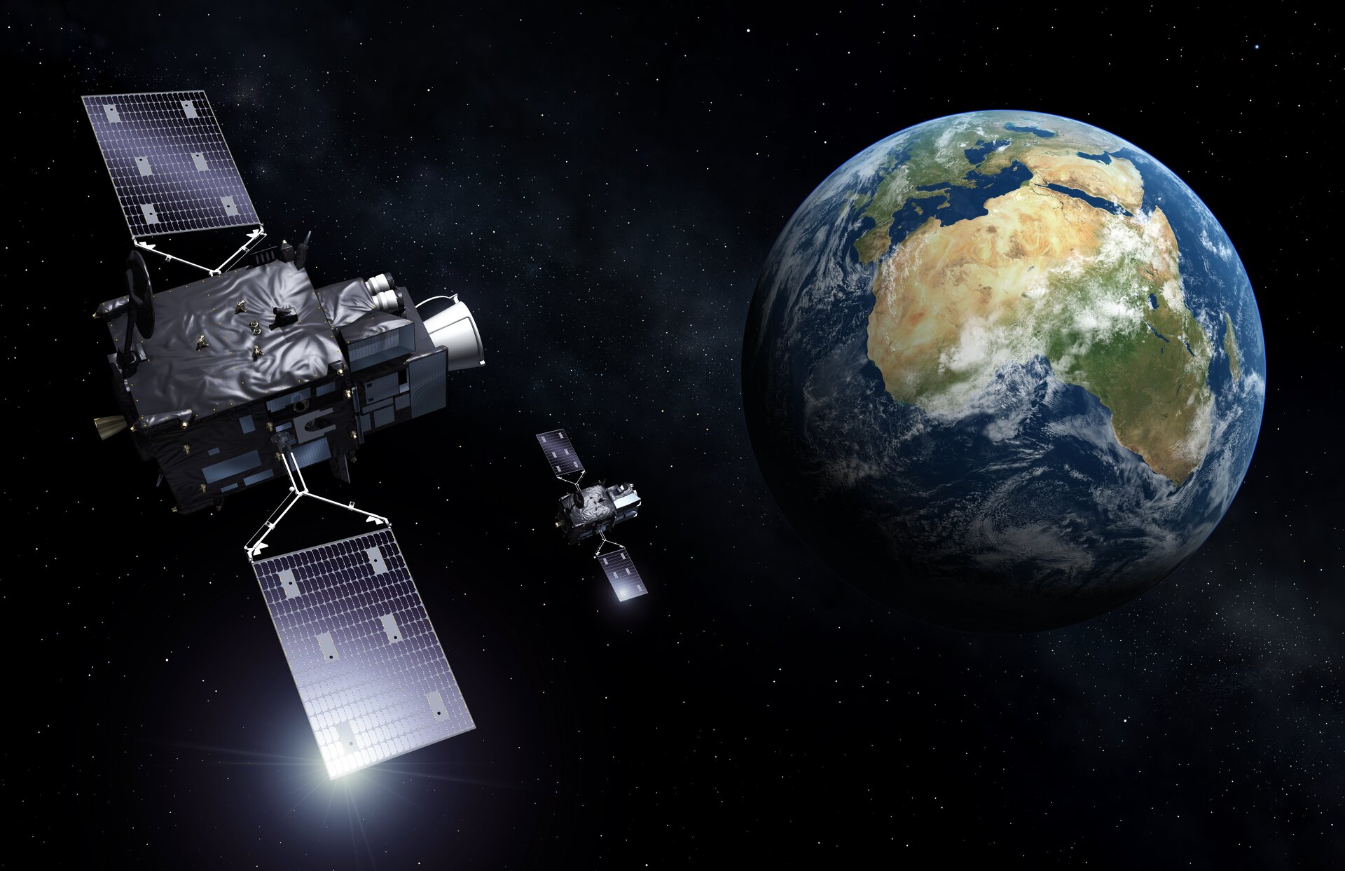
Satellite Weather already supports the newest EUMETSAT’s Meteosat Third Generation (MTG) high-resolution geostationary satellite

  • Higher spatial and temporal resolution on 16 spectral channels
  • True Colour spectral composite employing Rayleigh scattering correction 
  • Optimisation techniques for handling large data in visualisation and further integration

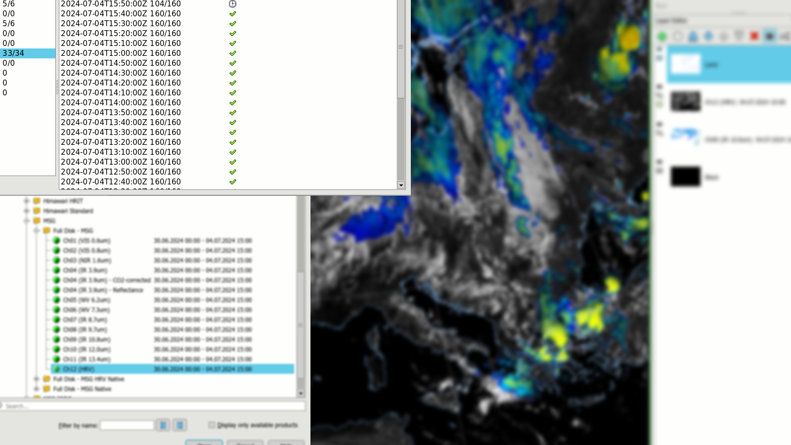
Further supported data includes imagery from MSG, Himawari, GOES and various derived products.

Powerful Visualisation

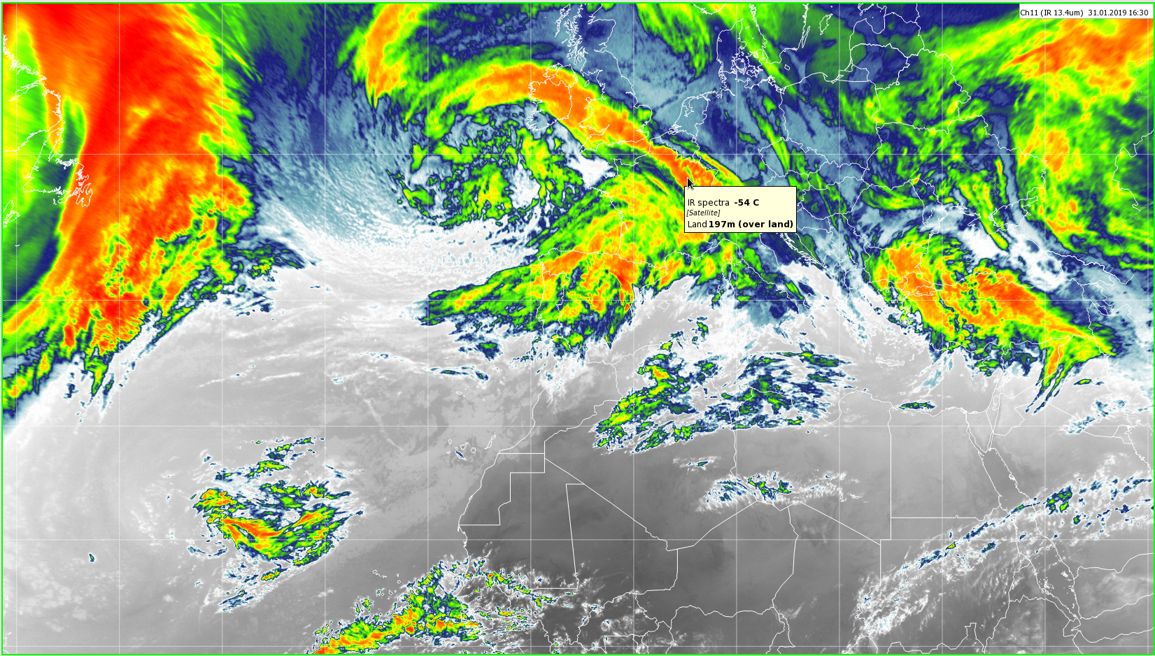
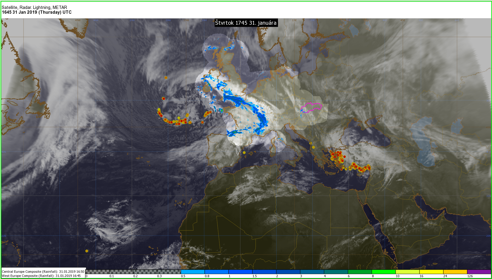
Display of the data is an essential functionality, either directly in the Satellite Weather or via integration with Visual Weather.

  • Multiple layers of satellite data, vector geography, overlay images
  • Overlay satellite imagery with derived (Level 2) satellite data
  • False colouring with user-defined gradients
  • Spectral composition using single spectral channels or their linear combinations
  • Animation of any of the above

Configuration and Monitoring

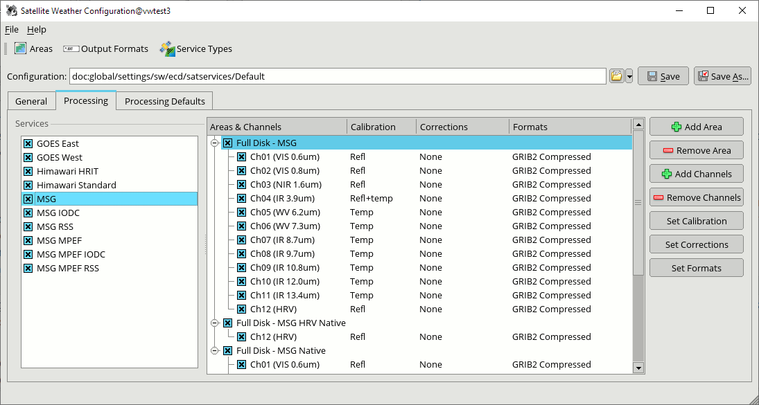
The complexity and flexibility of the processing tools are hidden behind a user-friendly graphical interface for configuration and monitoring.

  • Select the interesting satellite services and spectral channels
  • Define the desired projections and areas of the output
  • Choose a combination from applicable corrections
  • Select the desired output format based on the further usage of the data (meteorological or picture formats)
  • Monitoring of the incoming segments and produced output

Spectral Composition

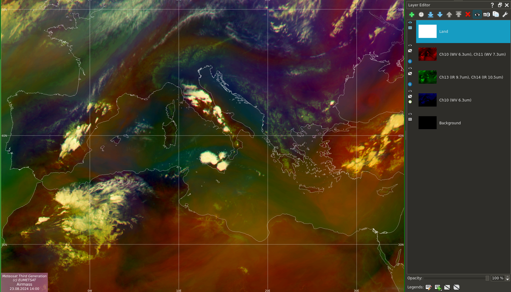
RGB spectral composites are useful for visually distinguishing between different states of the atmosphere and various atmospheric features.

  • Presets of EUMETSAT-recommended RGB spectral composites are delivered with the product, including Night microphysics, Dust, Airmass, Day Natural Colours, Convective Storms, Day Solar, Day Microphysics and more
  • User can create his/her own composites by selecting the individual spectral channels or their differences or other linear combinations
  • The colour gradient and gamma enhancement can be fine-tuned for each of the R/G/B channels

Derived Satellite Products

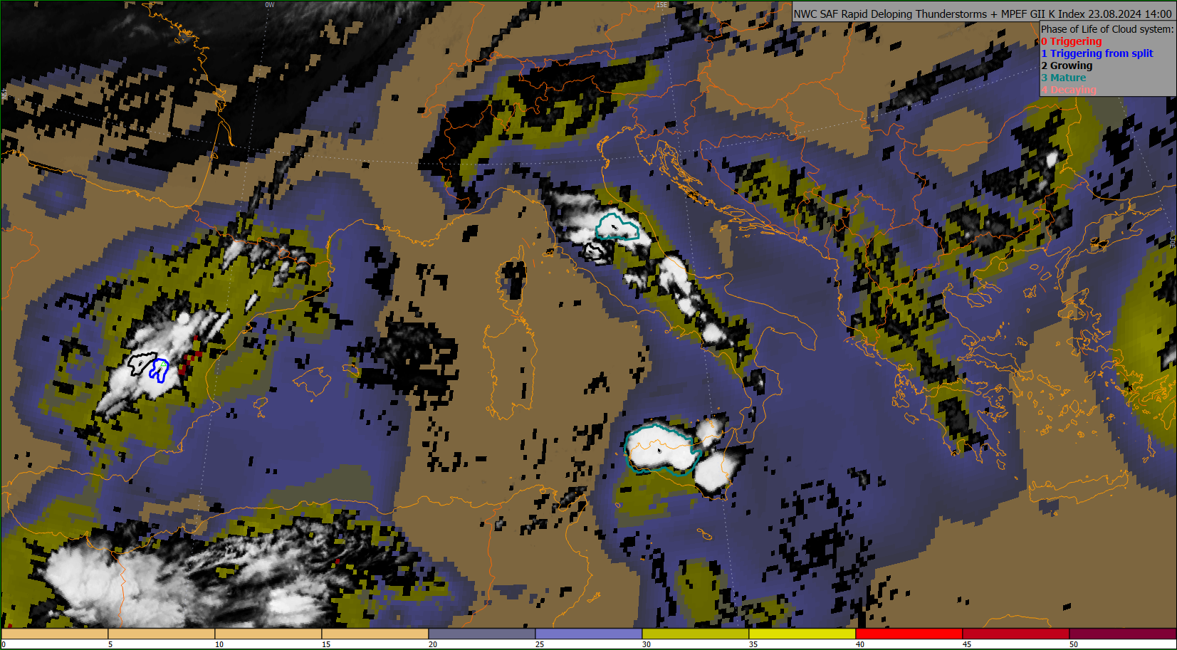
In addition to level-1 data, Satellite Weather can display various derived (level-2) satellite products.

  • MPEF products: Cloud Analysis, Global Instability Index, Atmospheric Motion Vectors, Cloud Top Height, etc.
  • Land SAF products: Land Surface Temperature, Surface Albedo, Surface Solar Irradiance, Snow Cover, Vegetation Cover, Leaf Area Index, etc.
  • Nowcasting (NWC SAF) products: Cloud Top Height, Cloud analysis products, Precipitation estimate products, Rapid Developing Thunderstorms (RDT), High-Resolution Winds (HRW), etc.
  • Lightning data (MTG LI, GOES GLM), Hydro-Estimator satellite rainfall estimates and more

In addition to the products coming directly via EUMETCast, IBL offers installation and configuration of the NWC SAF GEO software on your site, to calculate additional derived products.

Autonomous and Reliable Operation

Satellite Weather is designed for non-stop automatic operation, where stability is the foremost concern. 

  • Filtering and sorting of the incoming data
  • Watching for relevant segments and triggering the processing of the desired products, based on the configuration
  • Archiving and automatic house-keeping based on configured rules

Integration with more IBL Products

Satellite Weather can be a stand-alone solution to process and visualise the satellite data or integrated with other IBL products, e.g. Visual Weather, for further processing and production. Its distribution mechanisms allow further distribution of output and integration with other IBL or third-party software.

Visual Weather allows

  • Overlay of satellite data with other data sources
  • Use satellite data as guidance for production
  • Provide satellite data via OGC Web Map Service (WMS) for web applications (including IBL Online Weather), or other GIS use cases

Satellite Weather can produce data in various formats for further distribution, including GRIB or NetCDF, GeoTIFF, JPEG, PNG and other common image formats.

© 2005 – 2024 IBL Software Engineering. All Rights Reserved.
Webdesign by Art4web. Development by YNK media.